[Courtesy of Naver Labs]
SEOUL -- The artificial intelligence, robot and autonomous technology wing of Naver, South Korea's top web portal, vowed to complete a high-precision layout map of all major roads in Seoul by the end of this year that could be used for autonomous driving after all.
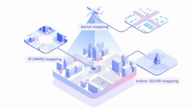
Naver Labs envisaged "A-CITY" as its final goal, saying it would integrate all space data including indoors, roads and sidewalks into high-precision map data to set up an autonomous driving machine capable of taking multi-roles accordingly to purposes and surrounding environments.
A-City is "an urban environment with automated and diversified infrastructures which are set up by using 'connections' created by a variety of devices which move city spaces and space data collected, analyzed and predicted by artificial intelligence and robots," Naver Labs head Seok Sang-ok said on Tuesday.
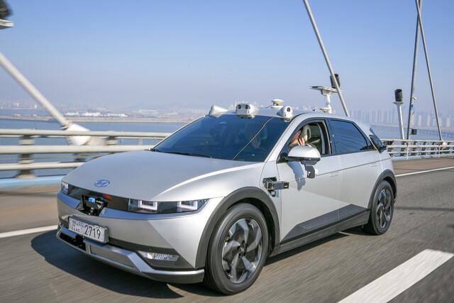
A three-dimensional map with precise information about traffic facilities is vital for creating an environment in which self-driving cars can safely roam about. Naver Labs said an upgraded Hybrid HD Mapping solution will be used to complete a layout map of roads with more than four lanes in Seoul. The map would cover about 2,000 kilometers (1,242 miles).
Naver is upgrading its location measurement technology by combining a high-precision map and various sensors. Self-driving robots will be allowed to run on roads, sidewalks and indoors
With super-fast commercialized 5G mobile communication networks, which can support autonomous vehicles and connected cars, SK Telecom (SKT) is also developing precision maps for self-driving cars. The mobile carrier has forged an alliance with HERE, an Amsterdam-based mapping and location data company, to develop 5G network-based mapping services and technology related to autonomous driving.
SKT plans to operate Cooperative-Intelligent Transport Systems (C-ITS), a next-generation real-time transport communication network infrastructure, using its high-precision map.
reporter

Park Sae-jin
swatchsjp@ajunews.com